ArcGIS Data Requests
This section provides code examples on how to access data from ArcGIS Image Services and Feature Services. For more information on the API services please see the ArcGIS Services Section. For ArcGIS REST API help please see the ArcGIS REST documentation.
Desktop Access
Access POWER Image Services in various desktop applications for further analysis, visualization, and geoprocessing (ArcGIS Desktop, ArcGIS Earth, ArcGlobe, QGIS, etc).
ArcGIS Pro
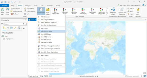
1. Open the "insert" ribbon at the top of the program window, then highlight the "connections" dropdown and select "New ArcGIS Server"
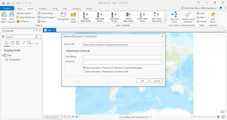
2. Enter the REST endpoint URL, any authentication if required, and click "OK"
QGIS
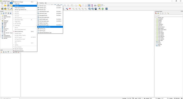
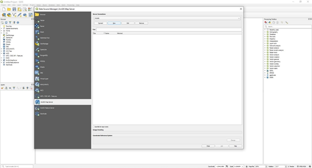
1. Click the "layer" dropdown at the top of the program window, then highlight "add layer" with your mouse and click "Add ArcGIS MapServer layer" from the menu that appears
2. Click the "new" button in the window that appears, then enter a name and the REST endpoint URL of the server you are connecting to. Click "OK"
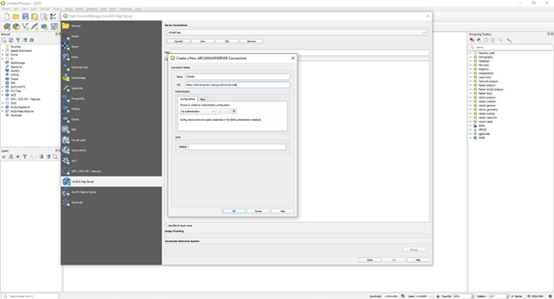
3. Click "connect"
Web Access
Access POWER Image Services and data in web and mobile applications using open source Web APIs and SDKs (JavaScript, Python, RStudio). Identify task - The identify operation is performed on a map service resource. The result of this operation is an identify results resource. Each identified result includes its name, layer ID, layer name, geometry and geometry type, and other attributes of that result as name-value pairs. You can provide arguments to the identify operation as query parameters.
Export Image task - The export image operation is performed on an image service resource. The result of this operation is an image resource. This resource provides information about the exported image, such as its URL, its width and height, and extent. Apart from the usual response formats of html and json, users can also request a format called image while performing this operation. When users perform an export with the format of image, the server responds by directly streaming the image bytes to the client. With this approach you don't get any information associated with the exported image besides the actual image. Users can provide arguments to the export image operation as query parameters. These parameters include the request extent, size information, interpolation, pixel type, and so on.